|
Werribee Survey Baseline
WERRIBEE VIC 3030 - Property No B5778
|
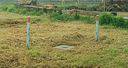
The Victorian Geodetic Baseline at Werribee was established in 1860 by Robert Ellery, Government Astronomer and Supervisor of the Geodetic Survey of Victoria.
Measured using three ten foot iron rods made in Victoria against the N.S.W. Standard originally obtained from the Ordnance Survey Department of Southampton, the baseline was five miles in length. Located on the plains on the east side of the Werribee River, north of the railway, it was extended northwards to a total of
... more
|
B5778
|
Regional
|
